JeffPo's
Mount Saint Helens Page
Last update: 10/12/97
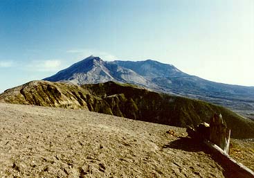 This
is Mount Saint Helens, which is an active volcano in southwestern
Washington. It had been dormant since 1857 but "blew its top" on May
18, 1980. As a result of the eruption, the mountain's elevation was decreased
from 9677 ft to 8364 ft. From where I snapped this picture, the surrounding
area looked like the surface of the moon.
This
is Mount Saint Helens, which is an active volcano in southwestern
Washington. It had been dormant since 1857 but "blew its top" on May
18, 1980. As a result of the eruption, the mountain's elevation was decreased
from 9677 ft to 8364 ft. From where I snapped this picture, the surrounding
area looked like the surface of the moon.
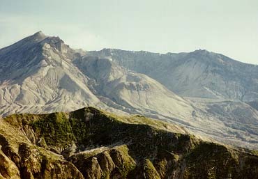 This is
a zoomed in shot of the Mount Saint Helens crater. That white spot
just below the crater rim, near the center (to the left a little), is actually
steam rising. It was more evident in the print than this scanned image.
This is
a zoomed in shot of the Mount Saint Helens crater. That white spot
just below the crater rim, near the center (to the left a little), is actually
steam rising. It was more evident in the print than this scanned image.
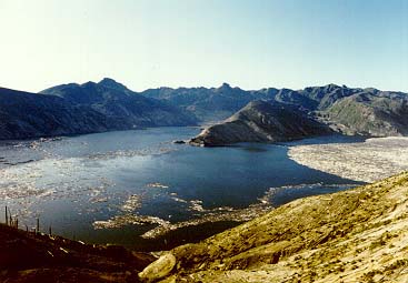 This is Spirit Lake, or
what's left of it. It was once a beautiful mountain lake but now it's
just a giant mudhole. The debris you see in the lake are actually trees
that were blown into the lake. There was a whole forest floating in
the there.
This is Spirit Lake, or
what's left of it. It was once a beautiful mountain lake but now it's
just a giant mudhole. The debris you see in the lake are actually trees
that were blown into the lake. There was a whole forest floating in
the there.
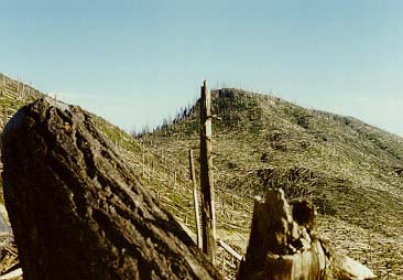 As you can see by this shot,
all of the surrounding trees were flattened like match sticks. Of course
the ones near the volcano were blown away.
As you can see by this shot,
all of the surrounding trees were flattened like match sticks. Of course
the ones near the volcano were blown away.
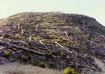 Here's a closer shot of the trees blown down around Mt. Saint
Helens. Keep in mind that these are BIG trees.
Here's a closer shot of the trees blown down around Mt. Saint
Helens. Keep in mind that these are BIG trees.
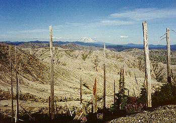 Here's
a shot looking toward Mt. Rainier (I think...might have been a mountain down
south). For about as far as you can see, everything was wiped out during
the blast.
Here's
a shot looking toward Mt. Rainier (I think...might have been a mountain down
south). For about as far as you can see, everything was wiped out during
the blast.
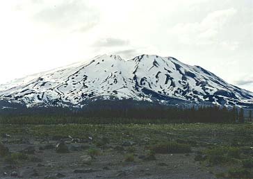 This
is a view of Mt. Saint Helens from the other side of the volcano.
This
is a view of Mt. Saint Helens from the other side of the volcano.
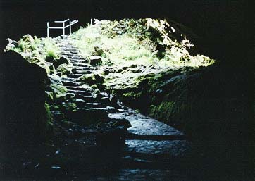 This
is the entrance to an ancient lava tube. We had a lot of fun exploring
these caves. They go for a mile or so and it's pitch black and
rather chilly. The passage varies a lot. Sometimes you're in
giant "rooms" and sometimes your'e in narrow "hallways".
This
is the entrance to an ancient lava tube. We had a lot of fun exploring
these caves. They go for a mile or so and it's pitch black and
rather chilly. The passage varies a lot. Sometimes you're in
giant "rooms" and sometimes your'e in narrow "hallways".
* Back to home page *